I've always heard it said that it's not healthy to live in the past, the future us unreliable because we are not guaranteed another day, and we must live in the present because it's the only reality we have control over. On some level, I agree with those mixed sentiments, but I think it creates a somewhat cynical perspective. The past is our key to where we have come from. The present is where we are right now. The future is where we want to go. I like to look at it like this: the past is what shaped me and showed me my mistakes; the present is guided by my past as I make daily decisions that will shape my unwritten future. If we live in the past, we become cynical and bitter. If we live entirely in the present, or better yet in the moment, we never advance our position in life by seeking to fulfill those things that we desire. If we live in the future we spend our time dreaming and we never reach our goals because we fail to do what is needed in the present to achieve the knowledge or raw materials to fulfill our dreams. Now certainly all of this philosophical diatribe may sound like utter nonsense, but it certainly applies to the processes that are required for properly planning various projects. In this case, I'm talking about a trail; more specifically, the Skyline Trail at Chimney Rock State Park.
I was fortunate to hike with some of the Friends of Chimney Rock State Park on their summer hike. The hike was led by Park Superintendent, James Ledgerwood, and was planned with the objective of reaching the top of Hickory Nut Falls via a newly proposed re-route of the Skyline Trail. This was the first opportunity for members of the public (exclusively members of Friends of Chimney Rock State Park) to go to the top of Hickory Nut Falls since the closure of the Skyline Trail back in 2008. For those of you who read my blog, you will remember that I visited the Skyline Trail last summer with Ranger Tyson to document the Skyline Trail in its present state, but other than me and the handful of people who have likely snuck out on the trail illegally, this was the first official public visit to the top of the falls.
I really appreciated the way James started this hike. We all met in the top parking lot at the tunnel entrance after a brief rendezvous at the Ticket Plaza. Of course, the elevator was down so James explained to the group that it was going to be a "day of decisions." Our first decision was made for us as James explained that we could ride the elevator, as it was operational for staff, but due to its lack of reliability, this might not be a good decision. Thus we opted to hike up through the Outcroppings via the newly constructed stairway that replaces the majority of old structure to places such as Vista Rock, Pulpit Rock, and the Subway/Grotto. The Subway and Grotto, along with Pulpit Rock are the most recent openings after being closed for many years so it was nice to re-visit those places again.
 |
| The stairs to the Outcroppings. |
 |
| The new stairs to the Grotto and Subway replace a structure that was old and in pretty poor shape. |
 |
| The view from the recently re-opened Grotto. |
 |
| The Subway was always one of my favorite attractions in CRSP. |
 |
| This recently added feature gets visitors back up to Pulpit Rock. What's your opinion of this structure? |
 |
| Another view up the steps to Pulpit Rock. |
Once we reached the patio and the steps to go up, once again James mentioned that it was decision time. This was our opportunity to visit the Chimney, go to the restrooms at the Sky Lounge, or continue on the hike. Our group opted to continue up the mountain. I made a conscious decision that I would take my pictures on the way back down. It was particularly hot and muggy and I was already sweating profusely, so I decided that I didn't want to take the effort to continuously remove my pack to get my camera out, nor did I want to carry it around my neck.
As we walked up through the switchbacks on our way to Exclamation Point we saw quite a few Sundrops (
Oenothera fruticosa subsp.
tetragona) that were flowering. Leatherflower (
Clematis viorna) and tall thimbleweed (
Anemone virginiana) were also beginning to open up. Mountain bluets (
Houstonia purpurea) grew in patches along the trail, announcing the arrival of the summer flowering season. At the top of the last long stairway before Exclamation Point, some shootingstar (
Dodecatheon meadia) plants remained, having already flowered and beginning to develop fruit.
 |
| Sundrops (Oenothera fruticosa subsp. tetragona) |
 |
| Tall Thimbleweed (Anemone virginiana) |
We arrived at the location of the recently removed Exclamation Point rain shelter. This was still standing on my last visit so it was fortunate that I had taken a picture of it at that time. Again, more decisions. Would it have been more appropriate to try to repair a structure that was in pretty rough shape to begin with, build a new structure, or tear the old one down and build nothing back in its place? The old shelter, while probably providing a crude layer of protection during thunderstorms, was probably not the safest place to be during said storms, so removal was probably a good idea. Not to mention, some of the colorful language written on the walls was certainly not something that children should be sitting around reading while waiting on the passing rain shower. Again, as so many things do, the rain shelter will pass into history as a memory as the future moves ever closer.
At the rain shelter, the hiker is presented with a choice of continuing straight ahead, around the bend to Exclamation Point, or taking the route to the left up the rock dome. I chose the latter as I was interested in seeing if there was any pale corydalis (
Corydalis sempervirens) along the edge of the forest. Unfortunately, I didn't see any so it may be that climate change has made the site less favorable and it is gone. The species was always somewhat sporadic there anyway, so it could be that this was just not the year for it to be there. Life is tough on the edge of a granite dome where soils are thin, water is often scarce, and the sun beats down on you most of the day.
 |
| They don't call it Exclamation Point for nothing. |
|
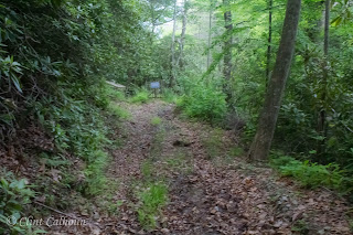
James assembled our group together after a quick look at Exclamation Point. He led us to the gate that has been erected at what I always called the orchard access road. James unlocked the gate and let us through, allowing us to walk a short distance. He began to explain the finer points of trail construction and some of the logic for constructing a new and improved Skyline Trail. The new proposed route would make partial use of the old orchard road before meandering into the woods along the contour about 25 yards above the old Skyline Trail. The route meanders through rhododendron thickets and will offer some really awesome views once some trees are removed and windows opened. As we walked along the recently cleared corridor, I was overcome by this feeling of deja vu. I then remembered that sometime back in the late 90's, Todd Morse and I had walked along the same route, although it wasn't cleared all those many years ago and was actually quite a difficult bushwhack. Now, with the rhododendron cleared out of the way, it was quite obvious that this was a very doable route. I wish I could remember the reason Todd and I scouted that route so many years ago. It is quite possible that we were looking for an alternative route for the Skyline Trail then, but I've slept a few nights since that time so there's no telling what we were actually doing. The newly cleared route came out where I expected which was above the Skyline Trail near Peregrine's Rest on another orchard access road. I was also pleased to see that the old picnic table was still there by the road. I've eaten a few Clif Bars and sandwiches at that old table.
 |
| The orchard road on the other side of the fence. |
 |
| Galax (Galax urceolata) |
 |
| Cleared path through the forest. Notice the big chestnut oaks. |
 |
| Another shot of the proposed route. |
So, just to give a little more background, these old roads have been used over the course of Park history for the purpose of bringing in materials for trail construction. At one time they were used for getting asphalt to the trails and some people still remember those sections of trail that actually had asphalt on them. Much later, after Last of the Mohicans was filmed, those roads served the purpose of getting lumber to the trail for construction of the numerous boardwalks that were put in place along the trail between Exclamation Point and Hickory Nut Falls. It's interesting how we have sort of come full circle.
My first memory of the Skyline Trail was when I was a child and visited, never knowing that such a huge part of my life and career would be dedicated to the Park. I remember walking along the trail on a narrow path of low-to-the-ground boardwalks that were basically constructed of 2 x 12 boards laid side by side and supported and elevated by 4 x 4 posts in order to reduce the erosion that had occurred along the trail bed, which for so many years had no form of protection from the damage caused by natural erosion and human impact. Park management at the time was foresighted enough to see what the long-term effects would be and developed a strategy for replacing those old structures which was essentially implemented a little at a time over most of two decades. It worked too. The new improved boardwalks provided a stable, even surface that made getting to the top of Hickory Nut Falls much easier, such that it was not uncommon to see people walking the trail in flip-flops. A down-side to this was that while protecting the natural resources and supposedly improving safety, it created a false sense of security as well. We commonly let our guard down when we have a perception of safety, and that's when accidents occur. What is so easily forgotten is that at one time the trails didn't have easy walking surfaces and nice picketed handrails. Hikers knew the dangers that existed and there was a sense of personal accountability. If you veered off the trail, there was a really good chance of falling to your death, so usually common sense prevailed. Again, decisions and choices guided those early decisions, and we find ourselves there once more.
State Parks, to their credit, have a pretty good understanding of the conundrum that exists with respect to the Skyline Trail. While they don't know the entire history, they know enough to understand that there has to be a balance between public safety, protecting the natural resources, and good stewardship of tax dollars. It is also a matter of what can be done quickly and inexpensively versus the alternative. This discussion was very much a part of the hike as we stood atop an outcropping overlooking the old Skyline Trail, just east of Peregrine's Rest.
 |
| View from above the old Skyline Trail near Peregrine's Rest. |
 |
| Another shot. |
 |
| The access trail from the Peregrine's Rest Orchard Road to the old Skyline Trail. |
We clambered down the old access trail to the old trail bed and walked down to Peregrine's Rest discussing the remaining difficulties that CRSP has in completing the trail to Hickory Nut Falls. As we hiked along the old Skyline Trail we passed by the Gorge's only known population of rock gnome lichen (
Gymnoderma lineare). This federally endangered species has suffered dramatic decline since it was last inventoried in 2005. No one seems to know why the species is disappearing at CRSP, but oddly enough, its decline seems to parallel the degradation of the Skyline Trail since 2008. Could it be that some human impact along that trail is necessary to ensure the population survives, considering that Park staff used to regularly maintain the trail corridor by cutting back overgrowth. Disturbance is such an important aspect in many ecological communities. It is quite possible that some disturbance is necessary to manage the species, particularly when there are so many other environmental hurdles that the species has to overcome. My feeling is that if no further study or management of this population occurs, CRSP is going to lose rock gnome lichen to natural succession that is occurring at unnatural rates due to global climate change. That's my hypothesis as to what's going on, now it's time for someone to prove me wrong.
 |
| View from Peregrine's Rest. |
 |
| Rock Gnome Lichen (Gymnoderma lineare) |
Our group meandered along, passing the skeleton of a long dead Carolina hemlock (
Tsuga caroliniana) that was struck by lightning back in 2001 and later succumbed to hemlock woolly adelgid infestation. The discussion centered around the fact that at one time there were no boardwalks along the Skyline Trail and very few handrails. The barriers were vast thickets of Carolina rhododendron (
Rhododendron minus) that lined the trail edge and more or less created a natural handrail that was impenetrable in all but a few places. The question goes back to whether or not you can still protect the natural resources without structure. Lack of structure probably reduces the number of users because of safety perception, but how does that impact a trail that already has significant damage from nearly 100 years of use? These are the types of questions that CRSP and NCSP staff are trying to get a better handle on. The answers are not always as cut and dry as we might like to think they are.
We finally arrived at the top of Hickory Nut Falls. As I had mentioned in last year's post on the Skyline Trail, the pool between the upper and middle cascade has changed quite dramatically. Rocks have moved around, aquatic plants are growing in a partially submerged sandbar. Small trees now lean over the creek where the upper cascades descend into the plunge pool. It is no longer easy to hike along the side of the creek to reach the flat rocks alongside the upper cascades where so many people used to sit in the sun, eat picnics, and slide down the waterslide (not something that we typically encouraged). The little bridge that served as the barrier between safety and danger has lost a handrail since I was out there last summer. Lack of maintenance and the movement of time continues to take its toll on the remaining structures.
Our group sat down at the top of Hickory Nut Falls for lunch and reminisced about what used to be and the various memories some of us had at the top of the falls. It was so much fun telling stories about the many people we encountered back in the good ol' days and the experiences. I keep saying that one day I'll write a book about some of that stuff. Maybe somebody will want to read it. One bonus for eating at the top of the falls is that currently there is an unobstructed view across the Gorge and along the cliff faces. The old fence and boardwalk at the falls is gone, most of which was washed away in 2006, opening the view. I snapped a few shots of the cascades and we headed back up the stairs.
 |
| Lower Cascades. |
 |
| View from the top of Hickory Nut Falls. |
 |
| View of the cliff faces from the top of Hickory Nut Falls. |
 |
| Middle Cascades. |
James led us up to the falls orchard access road along an old path that had consisted of old rotted steps built beside a long since removed rain shelter. I saw the old trashbin we constructed many years ago, still sitting there, almost as if it's waiting for more trash to be placed in it. The old bin was built like a cage out of wood and hardware cloth to serve as a place we could place full trash bags on weekends until we had a chance to put them in the back of a 4x4 truck that we would keep at the top of the falls in case of emergencies. The old orchard road allowed us to be able to get the truck in to the falls area and made a difficult job much easier. At this point, James showed us the area that was being considered for possible new trail as a way of connecting the area to the new corridor. The plan is not without its challenges. One of those challenges is the crossing of Fall Creek. Do we abandon the old trail completely, remove the old bridge and create an upstream crossing along the old access road bed or do we use portions of the old Skyline Trail and renovate the existing structure? A higher stream crossing means either building another bridge or wading the creek which adds a challenge element to the trail. Crossing the creek in the same place means upgrading the existing bridge and figuring out how to use the old trail in the safest way possible.
 |
| Falls Orchard Access Road, looking downhill towards Hickory Nut Falls. |
 |
| Old ford crossing upstream of the Cascades and a possible challenge for trail construction. |
 |
| A small waterfall at the ford crossing. |
James explained that when the trail crew scouted the new route above the old Skyline Trail, they ran into a very steep drainage area. I knew exactly where he was talking about as I had hiked that route before. The same drainage area is crossed by the old Skyline Trail over a mostly dry streambed. All possible new routes are choked with rhododendron thickets that are practically impenetrable, making it very difficult to properly plan and execute a feasible route. This shows the difficulty with creating something new where few options exist. So, this brought us back to the original question: what can be done to incorporate the old trail as opposed to creating new trail? As we walked back along the route we had taken, this question resonated with each hiker as we pondered the various choices that must be made with respect to the Skyline Trail.
 |
| Our merry band in single file on the proposed re-route. |
And what about the Cliff Trail? The Cliff Trail was the first trail to the waterfall and the location for the Last of the Mohicans. It is also the most awe-inspiring trail in the entire Gorge. How do we resurrect this trail in a safe and affordable manner? There are plenty of ideas but none that equal the experience of being able to simply walk unimpeded and without a guide. Having all the trails open to the public is the only way to truly restore the identity to CRSP. Sure the Park's namesake is Chimney Rock, but everyone who knows and loves the Park knows that the Park's heart and soul are the Skyline and Cliff Trails which make it possible to truly experience the awe and wonder of the mountain.
So what can the public do? It is important for the people who love CRSP to make your voices heard. Without voices, it is much harder to get clear direction, and the planning gets left to bureaucrats and engineers who don't know the Park and don't know its history. Do the trails need structures? Probably. Do those structures need to be engineered at the cost of hundreds of thousands of taxpayer dollars and then constructed for even more? Not likely. Engineers didn't build Chimney Rock State Park. Skilled carpenters and men with a lot of common sense built those trails and their work was good enough for the ones who ordered it. That is part of the Morse Family legacy. They did it right the first time. Granted, I'm not taking anything away from engineers because they are necessary, but why is it necessary to over-engineer a trail? Considering the overall safety record of the Park for several generations, low level of severe accidents and fatalities compared to other similar attractions, it tells me that somebody did something right. I visited Whiteside Mountain last year and they have trails that are very similar to CRSP and have similar issues. Whiteside is part of the Nantahala National Forest, has some of the most precipitous drops in eastern North America, and is not over engineered. Rather it has very simple structures that serve their purpose, are easy to maintain, are safe, and were inexpensive to build. In my opinion it comes down to being a good steward of the environment and the money of the taxpayers.
 |
| Cable fence is all there is between my wife and a 1,000 foot drop at Whiteside Mountain. |
 |
| If this is good enough for the national forest, surely it would work at CRSP |
So my plea to my faithful readers and Friends of Chimney Rock State Park is to make your voices heard. Let's return CRSP to its former glory, unencumbered by bureaucracy and overkill. Also, let CRSP staff know how much you appreciate them. Those guys and gals do a fantastic job and are faced with a lot of challenges that don't just involve the Skyline Trail. They have approximately 6,000 acres to look after. Give them your support and continue to support CRSP and the Friends of CRSP.
I just want to throw a huge shout-out and thank you to James Ledgerwood who so patiently and deftly fielded our questions and comments as he guided us along the trail . This hike would not have been possible without his willingness to share his vision with those who care so much about "our State Park." Below are a few more pictures I snapped while on our hike.
 |
| Path to Exclamation Point |
 |
| Close-up of the Devil's Head. |
 |
| The classic view of Chimney Rock. |
 |
| The climb to the top of the Chimney. |
 |
| View of the Rockpile from Pulpit Rock. |
 |
| View from the recently re-opened Pulpit Rock. |
 |
| Rock formation on top of Pulpit Rock. |
 |
| Banding and folding in the rock detailing the early geologic history of the Henderson Gneiss. |
 |
| Grotto Alumroot (Heuchera parviflora), a plant of extremes. |
 |
| Another view of the walk up the Outcroppings. |
Until next time!


No comments:
Post a Comment